INTERVIEW | “WAVESS multiplies the bathymetric surface that can be mapped in one day by 200”
The ESA Phi-Lab Spain team has interviewed those responsible for the WAVESS project: Bernat Gené Škrabec, technical manager, and Roger Huerta i Lluch, management manager.
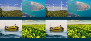
WAVESS, one of the ESA Phi-Lab Spain projects, introduces an innovative method for mapping and monitoring the Mediterranean coasts and other water bodies. The project combines Earth Observation (EO) and in situ data collected by Unmanned Surface Vehicles (USV). It is a joint initiative of Spascat, GPA Seabots and CTTC.
Barcelona, November 2025
1. To begin, could you briefly explain what WAVESS is and what is the main challenge it seeks to solve in the field of coastal and water body monitoring?
WAVESS is the answer to the need for scalability when performing bathymetric mapping of the near coast (that which reaches a depth of -15m).
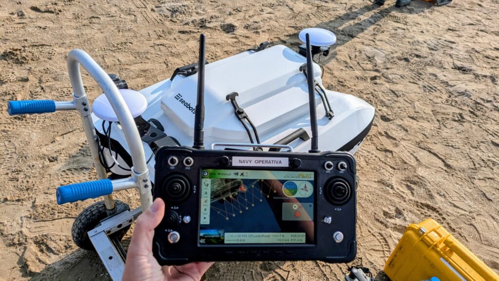
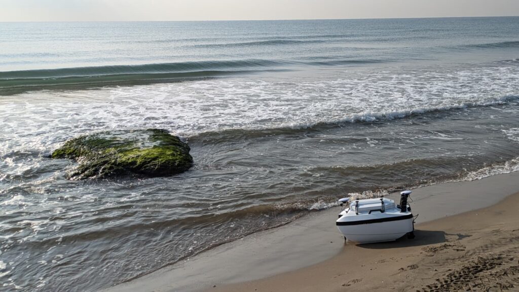
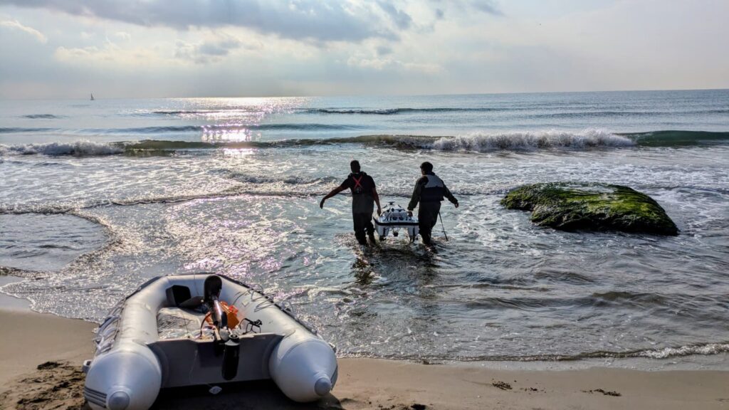
Currently, the mapping of the depth of the seabed is carried out by using echosounders to comb the sea surface by passing directly over it. These are transported by ships, which were traditionally manned, but more recently are remote-controlled: those known as USV – Unmanned Surface Vehicle. This mapping system requires passing over all the points that you want to map, causing, on the one hand, that it is almost impossible to map areas that cannot be accessed by ship (i.e. areas of swimmers, rocky areas, etc.) and on the other hand that the surface capacity to be mapped is limited by the speed of the vehicle and the time spent on it. These limitations cause the availability of updated maps of the bathymetry of the near coast to be linked to the economic capacity of the contractors, due to the direct correlation between the cost of carrying out a bathymetric campaign on the surface that can be mapped per day. On the other hand, the larger the surface to be mapped, the more days are needed, and therefore intensive post-processing is necessary to correlate the maps from different days (having an intrinsic variability due to the difference between the days) which lengthens the delivery times. The use of satellite images allows us to break with the limited framework in which these bathymetric campaigns operate. Using multispectral images, bathymetric reconstructions (SDB – Satellite Derived Bathymetry) of large surfaces can be made in a matter of seconds if they are combined with the ground truth data collected by the echosounders. This is where WAVESS comes in: WAVESS is a product that allows this correlation between satellite images and information from the echosounders in real time. This allows, at the cost of a reduction in resolution, to map up to x200 the daily surface area that a USV with an echosounder was previously capable of, in addition to allowing the delivery of the bathymetric map to the end client, already post-processed, in less than 24 hours.
“This allows, at the cost of a reduction in resolution, to map up to x200 the daily surface area that a USV with an echosounder was previously capable of.”
2. The Mediterranean and other coastal regions are increasingly vulnerable to phenomena such as erosion, sea-level rise or extreme storms. Why is it so important to have accurate and up-to-date bathymetric and environmental maps to respond to these challenges?
Bathymetric maps allow us to understand the availability and functionality of the natural barriers we have along the coasts. What is known as a submerged beach refers to all those accumulations of sand down to -15 metres in depth which, by their presence, are able to soften the impact of the sea currents that potentially degrade our beaches, as well as replenish them immediately after severe adverse weather events (i.e. Dana, Glòria). Having up-to-date bathymetric maps allows us to know how vulnerable our coast is, both the beaches which are at once important economic drivers and biodiversity refuges, as well as the built infrastructure immediately adjacent to it (in the Maresme we have the railway lines, and in the AMB we can find Barcelona-El Prat Airport, for example). The data from the bathymetric maps allow us to plan actions to help mitigate the effects of climate change on our coasts in an informed and objective way, as well as to quantify their effectiveness, and also to understand the changing morphodynamics of our coasts due to the effects of climate change.
3. WAVESS combines Earth observation from satellites with data collected in real time by unmanned surface vehicles. What makes this fusion unique compared with traditional methods, and how does it improve the accuracy and speed of the maps generated?
On the one hand, unmanned surface vehicles (USVs) offer a clear advantage over traditional methods, namely a reduced deployment of personnel on the ground and improved safety conditions for them. USVs can be operated safely and remotely, allowing routes to be pre-programmed before being deployed in the water, thereby increasing the automation of the entire process. Furthermore, depending on their dimensions, they can reach places where a crewed vessel could not, and can be transported with much greater ease. However, the USV on its own presents the same limitation as traditional methods: scalability. An USV can only map an area equal to the product of its battery operating hours and its maximum speed. If the contracted area is larger than this, the bathymetric campaign must be extended over several days, with the consequent need to redeploy the equipment and its operating personnel. Using multiple USVs simultaneously can alleviate this, but it does not solve it. Furthermore, there remains the need to cross-reference data from the different USVs and from the various days on which they have operated, introducing noise into the mapping and requiring the technical team to dedicate time to post-processing.
The introduction of satellite imagery with WAVESS overcomes these limitations. On the one hand, satellite images cover km²-sized areas that can be analysed all at once if supplemented with information from USVs, thus solving the scalability issue. Moreover, satellite imagery provides information on the entire coastline, whether it is accessible by USV or ship or not. On the other hand, being able to map the entire area of interest in one go drastically reduces the need for post-processing centred on stitching together different maps produced by different USVs on different days. Although the resolution of maps derived from satellite imagery is not as good as that achievable with an echosounder directly over the seabed, the scalability and speed it offers make it a competitive option.
4. Your system promises to reduce monitoring costs by up to 80% while also being more sustainable. What specific benefits can it bring to public administrations, ports, insurers or sectors such as aquaculture and tourism?
The authorities have the political mandate to maintain up-to-date maps of the territory, as well as to carry out the necessary actions to protect residents and infrastructure from the effects of climate change. A tool like WAVESS enables coastal mapping to be carried out more quickly and cheaply, allowing more actions to be undertaken for the same budget than those previously contracted and the information to be received more rapidly. In other words, political decisions that may be affected can be made on the basis of knowledge.
But WAVESS is not only focused on the public sector. In the private sector there are numerous companies interested in mapping the nearby coast in a cost-effective and rapid manner. On the one hand, port authorities responsible for keeping their waterways free of sediment, facilitating the entry and exit of vessels. Rather than being reactive when a storm literally deposits so much sand at the harbour entrance that it can render it unusable, proper bathymetric mapping allows for periodic, informed preventive measures to be taken as soon as unwanted accumulations are detected at the harbour’s edge.
On the other hand, sectors of port infrastructure (such as breakwaters) and dredging could, with a tool like WAVESS, map the areas where earthworks are needed, certify the volumes of sand contracted to be moved and those that have actually been moved, and ensure their correct placement in the desired areas. These certification actions are closely linked to the insurers behind them all: knowing the vulnerability of each coastal area can influence decisions on whether or not to invest, as well as the cost of insuring them.
5. WAVESS brings together Spascat, GPA Seabots and CTTC, and also has the interest of entities such as ICGC, OpenCosmos or BlueNetCat. How do your specialities complement each other and what role do these external collaborations play in the project’s success?
WAVESS is a project supported by three main pillars, corresponding to the specialisations of the three companies collaborating on it.
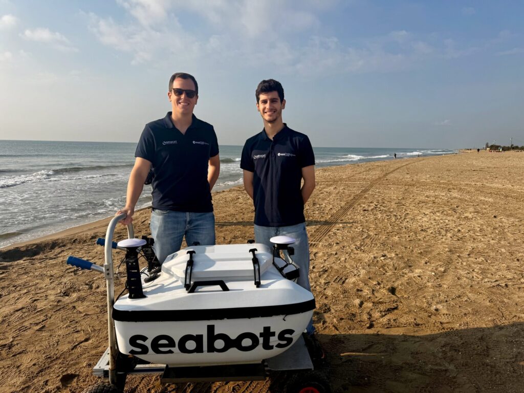
On the one hand, GPA Seabots is a company specialising in the development and commercialisation of USVs and their derived services. They specialise in carrying out automated bathymetric surveys in port areas, and provide expertise in the on-site operation of USVs as well as their technology.
On the other hand, the CTTC is the group’s scientific entity: The team involved has on its shoulders an entire career of scientific publications on the subject, which will allow us not only to pursue improvements in mapping the seabed and its movements using satellite imagery, but also to rigorously validate the results and capabilities of the WAVESS technology.
Finally, at Spascat we specialise in developing software platforms for the automated and recurrent analysis of multispectral satellite images. In the consortium we lead, we contribute our expertise and algorithms in SDB, as well as the technological integration of the various components to generate the WAVESS product.
Although the three entities work closely together, this project clearly aims for its independent commercialisation. That is why, from the outset, we have been seeking external collaborations that will enable us to enhance WAVESS’s technological capabilities (for example, with satellite imagery from OpenCosmos), validate use cases and functionalities independently (for example, with specialist technicians from the ICGC), and to seek potential clients interested in WAVESS’s capabilities (for example, the ecosystem around BlueNetCat). If we can enrich the project with all these other capabilities and viewpoints, we will be able to guarantee the success of the WAVESS project.
“We are seeking external collaborations that will enable us to increase WAVESS’s technological capacity”
6. Although the Mediterranean is your starting point, the system is designed to be globally scalable. In which other places or sectors do you imagine WAVESS could make a difference in the coming years?
The Mediterranean offers optimal operating conditions: low coastal turbidity, gentle tides and a generally pleasant climate, largely free of storms or clouds, which facilitate the use of multispectral satellite imagery and allow USVs to deploy safely. Nevertheless, we are making WAVESS robust enough to operate anywhere in the world, thanks to the currently global coverage of the satellites we use.
“We are making WAVESS robust enough to operate anywhere in the world, thanks to the currently global coverage of the satellites we use.”
The most logical places to continue WAVESS on a global scale are, first, to focus on seas with characteristics similar to the Mediterranean that allow its direct application (for example, the Gulf of California, the Black Sea or the Tasman Sea, to name just a few). Nevertheless, we are confident that WAVESS will be robust enough to operate in the Atlantic Ocean as soon as possible, which is the one closest to us. Furthermore, WAVESS can be used in inland bodies of water: throughout the project we will explore its potential for use in lagoons (such as those in the Ebro Delta), rivers and reservoirs. The latter, in particular, involve many maintenance tasks, which are critical for preparing us for the droughts to come. A tool like WAVESS could even allow for the near-continuous generation of bathymetric maps of critical areas.