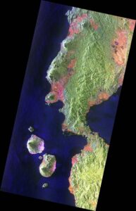
From space to the territory: meet the three winning projects of the 2nd Earth Observation Use Case Ideas Competition for the Private Sector
Meet the results of the three winning projects that have been part of the ESA Phi-Lab Spain portfolio, delivering data-driven solutions for agriculture, wildfires, and water management.
Barcelona, 30 July 2026

- REMOT is a project led by the company Spascat that uses Earth observation technologies to optimise vineyard irrigation
- SAPIC, developed by the company Lobelia Earth, is a viewer that provides information on wildfire risk in a given region
- TIAFA, carried out by MOAI Analytics, is a project for the automated detection of water leaks in hydroelectric canals
Earth Observation is a field with multiple applications, as demonstrated by the winning projects of the second edition of the ‘Earth Observation Use Case Ideas Competition for the Private Sector’. The initiative is promoted by the Government of Catalonia within the framework of the Catalonia Space 2030 Strategy and coordinated by the Institute of Space Studies of Catalonia (IEEC), in collaboration with the Cartographic and Geological Institute of Catalonia (ICGC).
The three winning projects, developed and tested over the past year, offer solutions in various fields. The REMOT project aims to use Earth observation technologies to optimise vineyard irrigation; SAPIC has developed a viewer with an indicator to report wildfire risk in any area selected by the user; and, lastly, TIAFA is a project for the automated detection of water leaks in underground and open-air canals.
All three cases have used data from Menut, the first Earth observation satellite mission promoted by the Government of Catalonia and managed by the IEEC, with technical support from the ICGC. These data have added value to each project by complementing the data obtained from other satellite constellations.
In this second edition of the call, the use cases have also been incorporated into the project portfolio of ESA Phi-Lab Spain. Phi-Lab Spain, co-funded by the Government of Catalonia and coordinated by a consortium led by the IEEC, is part of the European Space Agency‘s (ESA’s) ScaleUp Programme.
The three projects (REMOT, SAPIC, and TIAFA) establish themselves as successful examples of how climate and space intelligence can offer real, cost-effective, and data-driven solutions to climate challenges. Below you will find a description of each of them.
REMOT
The REMOT project, led by the company Spascat, involved Codorniu and AgroPixel as end-users. REMOT consists of the development of a precision irrigation tool to optimise agricultural irrigation across large expanses of land. This solution is based on artificial intelligence and the use of multispectral satellite imagery from the European Copernicus constellation, Planet, and Menut.
The main objective of the project is to offer field technicians and farmers an intuitive platform that facilitates decision-making when facing the complexity of managing large areas.
Over six months of work, the team designed an automated algorithm that calculates the water requirements of each plot by combining satellite data with past and forecast weather data. The algorithm distributes the weekly water volume evenly and intelligently, prioritising areas with the greatest needs. Furthermore, it has been adapted to the current climate crisis context by allowing the introduction of drought-related irrigation restrictions. As a result, the tool drastically reduces the time required to carry out a complex planning task to just a few seconds.
The effectiveness of this irrigation tool was successfully validated thanks to the collaboration of the end-user companies, AgroPixel and Codorniu, using real records from the 2025 campaign at the Raimat estate—the largest vineyard plot in Europe, located in the region of Segrià (Lleida). The results demonstrated the quality of the irrigation plans proposed automatically by the algorithm, showing that, besides being realistic, they offer more efficient proposals than traditional methods.
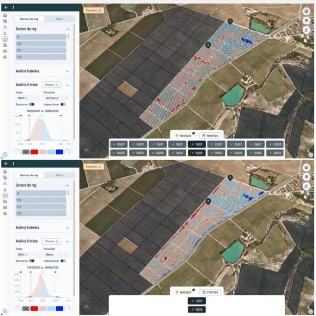
For the same time interval, we can see the comparative growth/decrease analysis for a group of irrigation sectors using Sentinel-2 images (top) and Menut images (bottom). Credit: Spascat
Thanks to the success of this use case, Spascat has integrated this new feature as an additional module within its web and mobile platform, REMOT.app. This platform was originally developed based on the experience of the previous use case (MOT), carried out within the framework of the first edition of the Earth Observation Use Case Ideas Competition for the Private Sector.
With this addition, the platform has evolved into an all-in-one agricultural management tool that centralises crop condition monitoring for fruit and wine-growing sectors, field inspection scheduling, and optimised irrigation planning.
SAPIC
The SAPIC project (‘Advanced Wildfire Prevention Service in Catalonia’), developed by the climate intelligence company Lobelia Earth, has presented an innovative tool for the improved prevention and mitigation of wildfires. SAPIC represents a paradigm shift, transforming traditional risk management from a reactive to a preventive approach. Through an interactive viewer, the system offers continuous monitoring of potential fire severity, generating regular maps that make it possible to identify precisely which areas of the territory are most vulnerable and what intensity a fire could reach at a specific point.
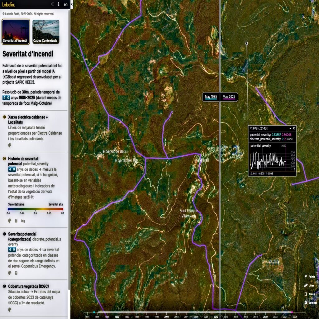
Screenshot of the visualisation tool. On the left, the list of layers shows the information/metadata for each individual layer. The timeline allows for the exploration and comparison of the vast amount of data generated by the project (40 years).
The key to SAPIC’s success lies in a powerful technological combination: it merges data from the Copernicus Sentinel-1 and Sentinel-2 satellites, complemented by data from the Menut mission, updated meteorological information, and terrain variables. These data sources feed an artificial intelligence model trained on 210 real wildfires in Catalonia. The algorithm integrates seven main predictor variables (such as canopy cover, land cover maps, the MSI moisture stress index, and the digital elevation model, among others) alongside the FWI meteorological index. This allows for the generation of risk maps with a resolution of between 10 and 30 metres—a level of detail previously inaccessible that far exceeds current standard indicators.
The efficiency of the model, which achieves a maximum accuracy of 70% in classifying severity into four categories, has been successfully validated by two end-users: PEFC Spain (a non-profit organisation that promotes sustainable forest management and certification) and the electricity company Electra Caldense, which operates 48 km of overhead medium-voltage lines in the regions of Vallès and Segrià. The results demonstrate that SAPIC is and will be a key asset for the protection of critical infrastructure, as it is estimated that it can reduce unnecessary inspections and maintenance tasks by 20% to 30%. This can translate into annual savings of hundreds of thousands of euros for managers of this type of infrastructure.
SAPIC has a very extensive potential market, considering that regions such as Southern Europe, California, Australia, or Chile have large forested areas and are exposed to an increase in the frequency and severity of large fires. In Catalonia alone, there are 655,700 monitorable hectares of woodland, and up to 2,600,000 hectares across Spain. Mitigation tasks guided by SAPIC can prevent or reduce the recovery costs of a major wildfire, which, in the most severe cases, can exceed €40,000 per hectare.
TIAFA
The TIAFA project, developed by the company MOAI Analytics, has transformed a theoretical risk model into an operational system for the automated detection of water leaks in hydroelectric canals. The system has successfully achieved the validation phase in a real environment, having been implemented on canals located in the province of Lleida. This pilot environment presents a high topographic, environmental, and operational diversity, making it a representative scenario for evaluating the system’s performance. During the inspection campaign, carried out across 112 kilometres of the company Endesa‘s network, the tool confirmed several real breaches and identified other critical cases that should be kept under observation.
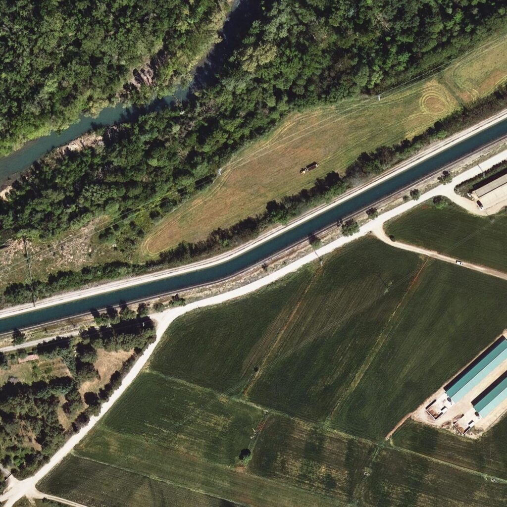
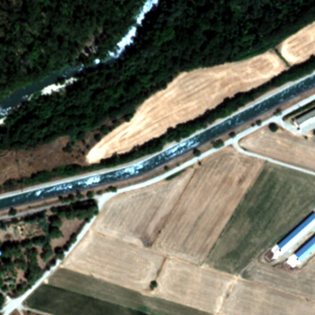
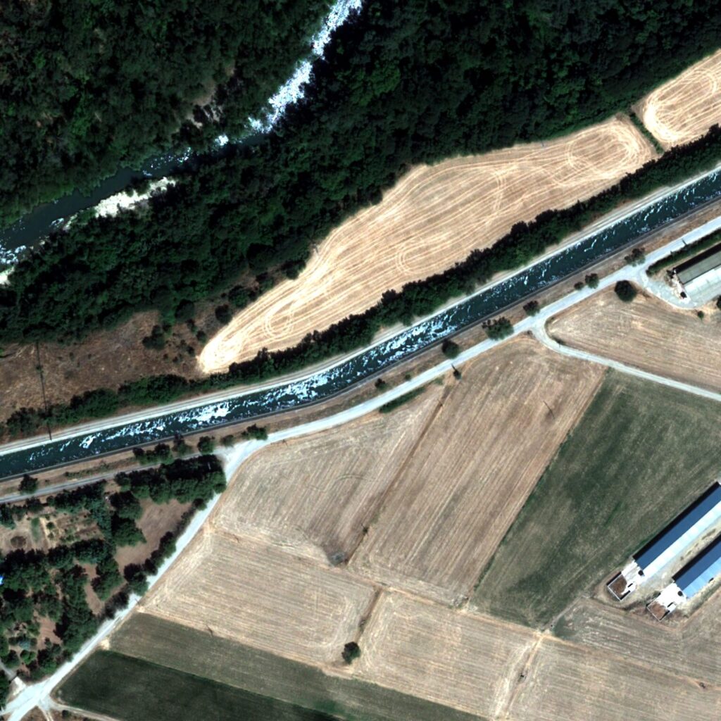
Comparison of airborne and satellite EO products. From left to right: airborne multispectral image from the ICGC (25 cm GSD), Airbus satellite image with a spatial resolution of 1.2 m and higher radiometric quality, and a very-high-spatial-resolution (~30 cm) Airbus satellite image obtained through pansharpening. The images correspond to a probable case of a breach currently under observation. The figure illustrates the differences in spatial resolution and the complementary nature of satellite products for the inspection and monitoring of the case. Credits: MOAI Analytics
TIAFA is a comprehensive and scalable system that integrates capabilities for the automatic acquisition of very-high-resolution multispectral satellite imagery, advanced spectral analysis, automated image preprocessing, the integration of ancillary data to improve accuracy, and temporal analysis to enhance the reliability of detections. The system functions as a pre-selection and prioritisation tool, which classifies suspect cases by levels (green–yellow–red), making it possible to optimise resources and direct field inspections to the points where they are truly needed.
The trials have also served to evaluate the system’s scalability potential through the use of public medium-resolution satellites, such as the Menut mission. The research has led to the design of a mixed methodology that combines these public satellites for broad territorial screening with commercial high-resolution imagery for finer validation.
With the completion of this project, TIAFA establishes itself as an operational tool to support the management and maintenance of hydraulic infrastructure, with a direct impact on efficiency, risk reduction, and resource optimisation. The results obtained demonstrate the technical soundness of the solution and consolidate a new line of operational activity focused on the early detection of failures in critical infrastructure through Earth observation.
Read the full IEEC article for more details and project media.
About ESA Phi-Lab Spain
ESA Phi-Lab Spain is a programme of the European Space Agency (ESA), supported by the Spanish Space Agency (AEE) and the Generalitat de Catalunya. The programme is part of ESA’s ScaleUp Programme, with a focus on promoting innovation and the commercialisation of space technologies to enhance climate resilience.
The programme is coordinated by the Institut d’Estudis Espacials de Catalunya (IEEC), which leads a consortium of twelve universities, research and innovation centres, and companies. These include the i2CAT Foundation, the Cartographic and Geological Institute of Catalonia (ICGC), the Fundación General CSIC, the KIMbcn Foundation, Arribes Enlightenment, the University of Valencia (UVEG), the Polytechnic University of Catalonia (UPC), the Barcelona Supercomputing Center (BSC-CNS), the Ricardo Valle Institute of Innovation Foundation (INNOVA IRV), the ESA MELiSSA Pilot Plant of the Universitat Autònoma de Barcelona (UAB), and the Institute of Photonic Sciences (ICFO)