VIALNAT
MONITORING SERVICE FOR NATURE-BASED SOLUTIONS IN INFRASTRUCTURE IN CATALONIA

Introduction
Linear infrastructures, such as roads and railways, are highly vulnerable to extreme climate events, which cause significant economic losses, service disruptions, and safety hazards. Consequently, infrastructure operators urgently need to transition from reactive maintenance models to preventive and adaptive ones. While Nature-Based Solutions (NbS)—like slope bioengineering and adaptive revegetation—are critical for climate adaptation, there is currently a lack of scalable data regarding their real-world effectiveness. Monitoring these living, dynamic solutions through conventional field inspections is expensive, inefficient, and difficult to scale.
Objectives
VialNAT aims to develop a satellite-based service to monitor the physical condition of critical infrastructures and measure the impact of their associated Nature-Based Solutions. The project seeks to provide continuous, objective, and large-scale information to facilitate predictive maintenance. By doing so, the solution intends to reduce field inspection costs, enable early risk detection, and provide quantifiable, standardized metrics to support technical decision-making.
The proposed solution will leverage Earth Observation (EO) data from satellites including Sentinel-1, 2, and 3, Landsat and SMAP/SMOS. The solution will also incorporate Earth Observation data from the Catalan Space Strategy’s missions as a demonstrator.
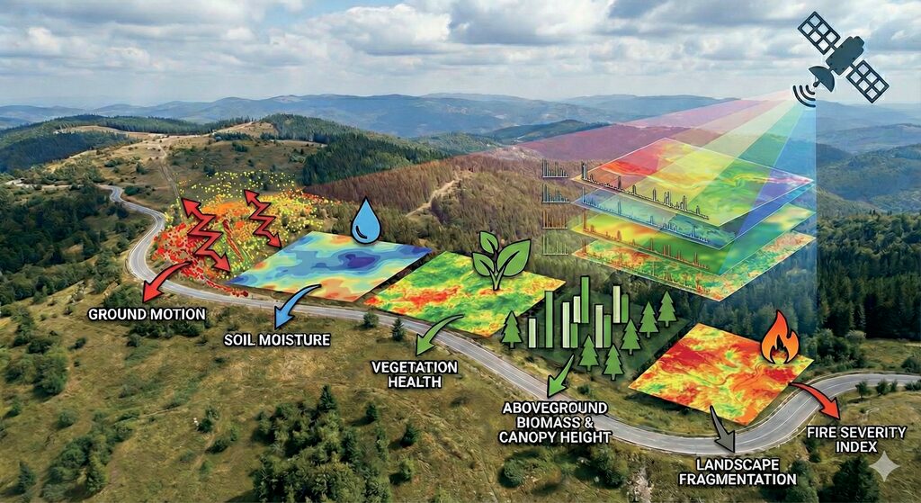
The innovation lies in transitioning from static geological models to dynamic risk models by combining over a decade of historical satellite data with continuous multi-spectral observations. By applying advanced algorithms, the service will generate key metrics such as ground motion, soil moisture changes, vegetation health, biomass, and fire severity.
Impact on Climate Resilience
VialNAT is designed to strengthen systemic climate resilience by allowing stakeholders to proactively assess environmental risks —such as landslides, floods, and wildfires— along extensive infrastructure corridors.
The tool will allow operators to evaluate the true efficiency of NbS by monitoring indicators like vegetation cover, water retention, and erosion reduction before and after extreme weather events. Ultimately, this science-based approach aims to ensure that adaptation investments are placed where they are most effective, minimizing operational disruptions and protecting the territory. FITXES_Phi-Lab_Imprimir_15092026
From Lab to Market: Customers and Commercial Roadmap
The project targets a high-value B2B and B2G niche market focused on public infrastructure managers (e.g., territorial departments) and private construction and maintenance operators who handle large-scale networks.
- SaaS: access to an interactive webGIS dashboard for preventive monitoring.
- DaaS: Direct integration of high-resolution data layers into the clients’ internal maintenance management systems.
- Advisory: Specialized technical reporting for environmental audits and NbS certification.